
LATEST
SAT 3 OCT 2026
In the newsSAT., OCT. 3, 2026 • VIDEO REPORT

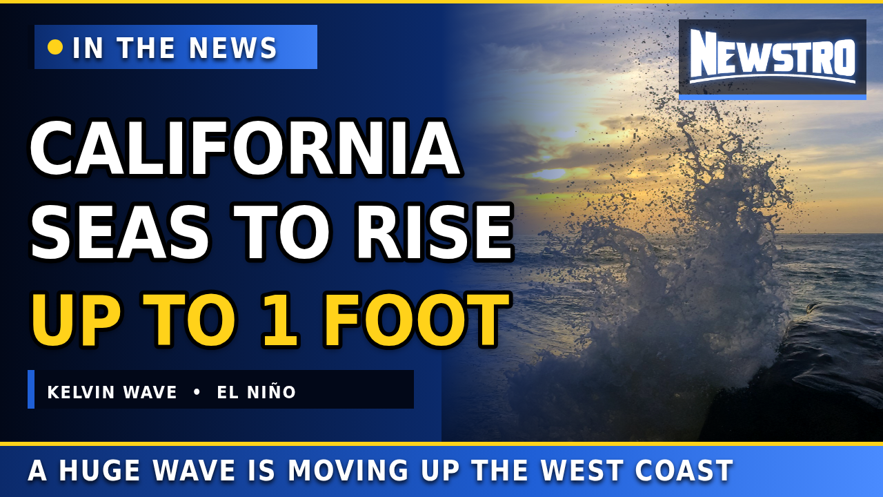
California Sea Levels Set to Rise as Kelvin Wave Surges Up the Coast

Sea levels in California could rise by as much as a foot in the coming days as an enormous wave tied to El Niño travels up the U.S. West Coast, AFP reports.

Video thumbnail: California Sea Levels Set to Rise as Kelvin Wave Surges Up the Coast 2:57
1 FTPossible rise
~6 MPHWave speed
1 WEEKUntil San Diego

What’s happening

Sea levels in California are set to rise by as much as a foot (30 centimeters) in the coming days as an enormous wave washes up the U.S. West Coast, AFP reports. The surge of energy, known as a “coastal trapped wave” or “Kelvin wave,” is part of El Niño.

The Kelvin wave is not like a tsunami and does not crash on beaches. It is a sustained bulge of excess water up to 18 miles (30 kilometers) wide that will hug the coastline as it travels all the way up to Alaska.

Oceanographer Dillon Amaya of North Carolina State University said the higher sea levels could combine with storm surge, large swells or astronomically high tides to raise the risk of flooding and beach erosion.

In recent weeks, storm surges have eaten away at beaches and damaged properties in parts of Southern California. In Dana Point and Laguna Beach, several houses have been left uninhabitable, and at least one has completely collapsed.

Newstro reports facts and attributes every statement. Photos marked “file photo” are from other dates; none show the current wave.
The Newstro report

▶ Watch this report on YouTube

Read the transcript click a paragraph to jump to it in the video
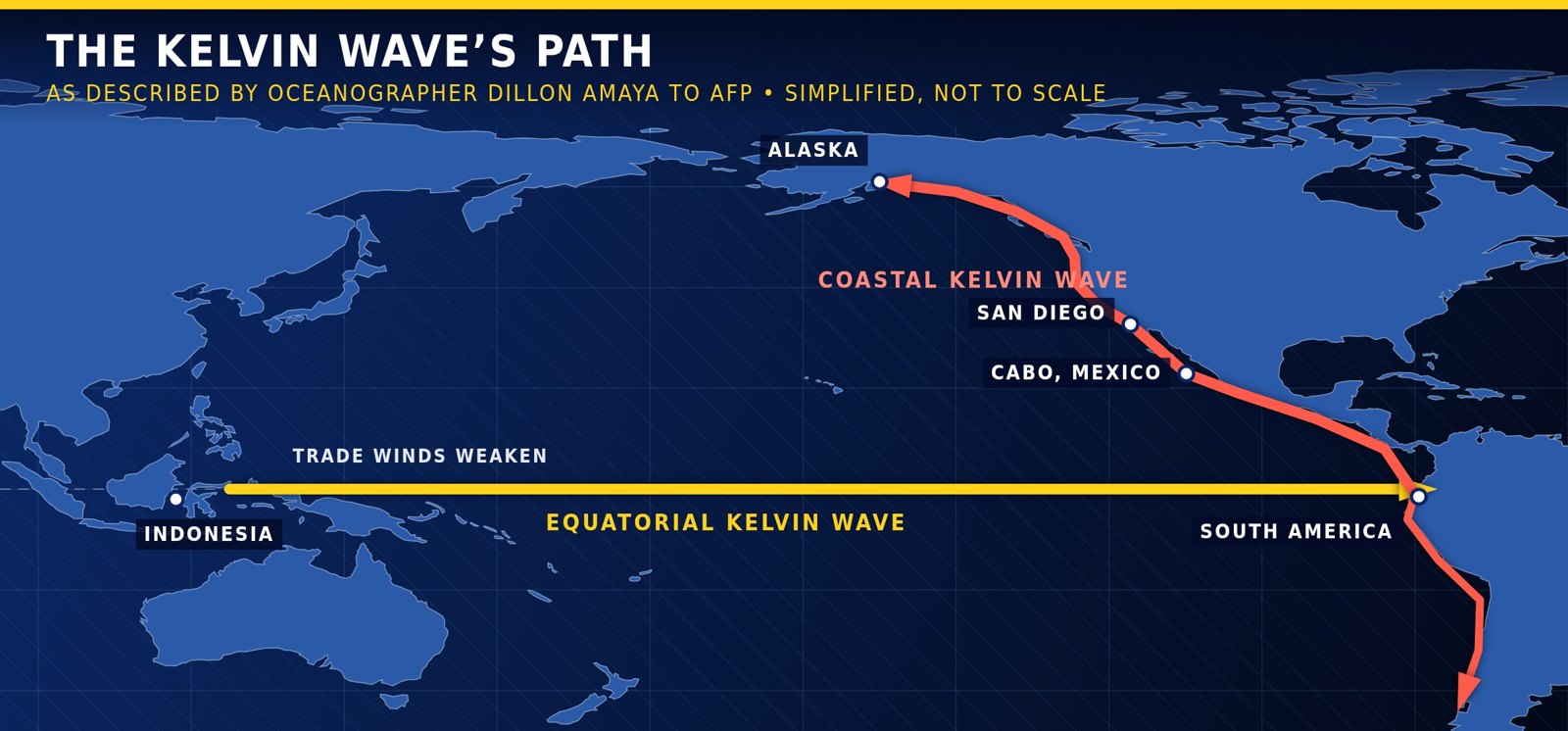
Newstro map of the Pacific showing the Kelvin wave traveling from Indonesia along the equator to South America, then north along the coast past Cabo and San Diego to Alaska
MAP: NEWSTRO (SIMPLIFIED, NOT TO SCALE)

The wave’s path

The wave starts near Indonesia when trade winds die down and warm water sloshes back along the equator toward South America.

There its energy becomes a coastal Kelvin wave heading north and south. Amaya said the U.S.-bound wave is somewhere north of Cabo, Mexico, traveling about six miles an hour, and he expects it to reach San Diego within the next week.

~6 MPHSpeed up the coast
1 WEEKUntil San Diego, Amaya expects

How it forms

  1. Trade winds normally hold up a large amount of warm water in the western equatorial Pacific by pushing on the surface waters as they blow.

  2. If the winds weaken for too long, the water moves back along the equatorial strip from Indonesia to South America as an equatorial Kelvin wave.

  3. The wave suppresses cold water that usually rises from the deep ocean, raising surface temperatures. Amaya called Kelvin waves “in many ways, the driving force of El Niño.”

  4. When it hits South America, the energy converts into a coastal Kelvin wave traveling along the continents, including up the U.S. West Coast toward Alaska.

The expert

“Every two to four inches (5–10 centimeters) of sea level rise that we see in that background state essentially doubles your flood risk.”

Dillon Amaya, North Carolina State University

“So it doesn’t sound like a lot, but because it’s over a huge volume of water… you start to get the flood risk.”

On why a small rise matters

“There’s lots of anxiety about extra flood risk coming from El Niño and these waves.”

On Southern California

Quotes from Amaya’s telephone interview with AFP.

Sources and credits

Reporting

Yahoo News / AFP — “Sea levels to rise in California as coastal wave surges up west coast” (Huw Griffith, Oct. 2, 2026).

Photos (Wikimedia Commons)

  • Windansea Beach, San Diego — Matthew T Rader (CC BY-SA 4.0)
  • Map data — Natural Earth (public domain)

Graphics and layout: Newstro. The video also uses photos of Laguna Beach (Azamat Taskynbekov, CC BY 4.0), Dana Point (Mertbiol, CC0), Malibu (Prayitno, CC BY 2.0), San Diego (Mds08011, CC BY 4.0), Cabo San Lucas (Serge Freeman, CC BY-SA 3.0) and NOAA Climate.gov’s November 2015 El Niño ocean temperature map (public domain).